(14.0 miles)
This driving tour retraces the movement of John Stark from his headquarters at the Catamount Tavern to the final encampment on August 16. The Battle of Bennington was one of the most significant battles of the War. The British lost over 1,000 soldiers, more than they lost killed or wounded in the Battle of Saratoga. More than that, it was a moral victory that showed the Patriots that they could stand up to the British and German forces.
The Monument
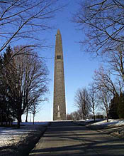
Erected to commemorate the historic Battle of Bennington, construction of the Bennington Monument was begun in 1887. At three hundred and six feet tall, it is the tallest structure in Vermont. It was completed in 1891 and was dedicated by President Benjamin Harrison on August 19th of that year. Over the years several commemorative additions have been made to the site include a statue of Seth Warner, a bronze tables set in a granit boulder placed in honor of General John Stark and the 1400 militiamen he brought from New Hampshire as well as a bronze statue of General Stark. Inside the monument itself is a historically accurate diorama, depicting the Second Engagement of the Battle of Bennington.
The Continental Storehouse
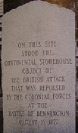
On the west side of the monument, where the gift shop is currently located, is the site of the Continental Storehouse which held supplies for the American Army. This storehouse was the object of the British advance to Bennington. The Battle of Bennington, fought to repulse this British attack, is considered to be a major turning point the the struggle for American independence.
After viewing the monument and the gift shop, drive south on Monument Avenue about 0.3 miles to the Catamount Tavern Site.
ON THIS SITE STOOD THE CONTINENTAL STOREHOUSE
OBJECT OF THE BRITISH ATTACK THAT WAS REPULSED
BY THE COLONIAL FORCES AT THE BATTLE OF BENNINGTON
AUGUST 16, 1777
Catamount Tavern
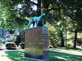
Catamount Tavern is where the Green Mountain Boys were formed and met. Here they planned the attack on Ft. Ticonderoga. From here, in May of 1775, Ethan Allen, the Green Mountain Boys, and patriots from Connecticut and Massachusetts left to capture Ft. Ticonderoga (NY) on May 10, 1775 which was America’s First Victory in what was to become the Revolutionary War. Here General John Stark, Colonel Seth Warner, and others held council in anticipation of the Battle of Bennington in 1777.
The Catamount poised on the pedestal is facing New York to warn the Yorkers to stay away. The Green Mountain Boys were formed to defend the property rights of the New Hampshire Grants against the claims of New York. The Tavern burned in the 1800s; the house is set back further than the tavern was.
SITE OF THE CATAMOUNT TAVERN, 1767
From the Catamount Tavern, continue south on Monument Avenue, crossing Route 9.
Ethan Allen Homestead
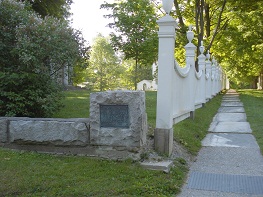
Ethan Allen lived on the southeast corner (of what is now Monument Avenue and Route 9) from 1769-1775. Although Ethan Allen did not participate in the Battle of Bennington, his Green Mountain Boys, now led by Colonel Seth Warner, were instrumental in achieiving victory. Allen had led his Green Mountain Boys in the capture of the British military installations of Fort Ticonderoga and Crown Point two years ealier. The capture of Fort Ticonderoga is considered to be the first American victory in the Revolutionary War.
A FEW FEET SOUTH FROM THIS STONE STOOD THE HOUSE IN WHICH ETHAN ALLEN LIVED WHILE HE WAS A RESIDENT OF BENNINGTON 1769 -1775
The Old Green
The corner of Monument Avenue and Route 9 is known as the Old Green. Bennington’s original Meeting House (the predecessor to the Old First Church which is on the left and which was dedicated on January 1, 1806) stood on the center green and held 700 British prisoners after the Battle. A twelve foot by six foot marker lays flat in the center of the Old Green, showing the location of the Meeting House. On your right, you pass the former Dewey’s Tavern (more recently called the Walloomsac Inn and now a private residence) which housed prisoners and provided food for prisoners and troops. The white house across Route 9 is the former home of Nathaniel Brush who, like Dewey, was a captain in the Battle of Bennington.
Go west on Route 9 about 1.5 miles to Colgate Park.
Hubbell Homestead
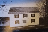
The prerevolutionary house at Colgate Park, built in 1768, is the former home of Aaron Hubbell who brought prisoners back to Old Bennington after the battle.
Continue west on Route 9 for another 0.9 miles to the intersection of Route 9 and Dermody Road. Turn right, off Route 9 onto Dermody Road, park and walk across the road to see the marker up close. There is a lot of traffic on Route 9 so look both ways before crossing!
Dimmick’s Tavern
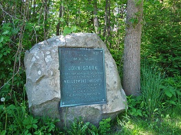
There is a large stone on the left side of Route 9 just east of Dermody Road. Dimmick’sTavern is the name on the stone, but at the time of the Battle, the name was Herrick’s Tavern. When General Stark brought his troops down from Manchester, this is where they camped for the first few nights (August 9-13). The Tavern was on the west end of town on the road leading to Albany. There may have been some thought at the time that the British would come from Albany. In any event, on August 14th, General Stark moved his men to a hillside in the northwest corner of Bennington about 5 miles north of this point. The position was then taken up by a smaller group of militia from Connecticut and Massachusetts. The group had come up from Pittsfield, Massachusetts under the leadership of the Reverend Thomas Allen.
1777-1927
SITE OF DIMMICK TAVERN WHERE JOHN STARK AND HIS NEW HAMPSHIRE VOLUNTEERS
CAMPED BEFORE THE ENGAGEMENT AT WALLOOMSAC HEIGHTS WHERE THEY LED IN THE WINNING OF
A DECISIVE VICTORY OF THE AMERICAN REVOLUTION THE BATTLE OF BENNINGTON AUGUST 16, 1777
ERECTED BY THE STATE OF NEW HAMPSHIRE
Go north on Dermody Road (about 0.9 miles, for a cumulative total of 3.4). Turn left onto Walloomsac Road and continue for 0.5 miles (3.9) to Whipstock Road and turn right. Continue 0.8 miles (4.7) and the road will turn sharply to the right at which point it becomes Vail Road. Continue 0.4 miles (5.1) to the corner of Airport Road where a sign on the southwest corner marks the location of Harmon’s Tavern.
Harmon’s Tavern
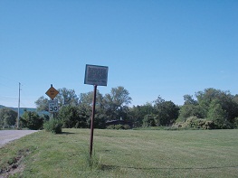
Harmon’s Tavern is where General Stark reportedly had breakfast on the morning of August 14, 1777. The Harmon Tavern is about half way between Herrick’s (Dimmicks’) Tavern and the camp on Harrington Road. It is about a mile from Seth Warner’s home.
Daniel Harmon had come to Vermont from Suffield, Connecticut. Daniel fought with the Green Mountain Boys in the Battle of Bennington, 2 miles to the north.
The Tavern was on a main trade route from Montreal to points south. This may explain why two boys who grew up in the area were aware of and attracted by the opportunities to travel north to Montreal. Two noted explorers born in Bennington during the Revolutionary War, went to Montreal, joined the Northwest Trading Company, and explored western Canada.
Daniel Williams Harmon was born here at the Tavern on February 19, 1778, less than a year after both 1) Vermont had declared its independence and 2) the Battle of Bennington. The family moved to Vergennes in 1795 and later Daniel moved to Montreal where he joined the Northwest Company. From 1800 to 1819, he explored western Canada, writing a highly respect journal on his experiences.
A couple miles to the west, Simon Fraser was born in 1776. His father was Captain Simon Fraser and he fought in the Battle of Bennington on the side of the British. Coincidentally, one of General Burgoyne’s most seasoned and effective fighting generals was also named Simon Fraser. General Fraser pursued the Green Mountain Boys when they evacuated Ft. Ticonderoga in 1777, catching up to them in Hubbardton. General Fraser was killed in the Battle of Saratoga in October of 1777.
Simon’s family moved north in 1783 for several years before young Simon moved to Montreal where he joined the Northwest Company and went west in about 1800, returning in 1819.
TWO HUNDRED FEET WEST OF THIS MARKER STOOD THE TAVERN BUILT BY CAPAIN DANIEL HARMON BUILT ABOUT 1771. GENERAL JOHN STARK HAD BREAKFAST IN THE TAVERN, AUGUST 14, 1777. DANIEL WILLIAMS HARMON, NOTED CANADIAN EXPLORER, WAS BORN IN THE TAVERN, FEBRUARY 19, 1778.
MARKER ERECTED BY BENNINGTON BATTLE MONUMENT AND HISTORICAL ASSOCIATION , 1950.
Continue east on Vail Road for 0.3 miles (5.4) and then turn left onto Austin Hill Road. Continue 0.8 miles (6.2) to the end and turn left onto Murphy Road. Go down Murphy Road for 0.3 miles (6.5).
Breakenridge Farm
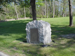
On July 19th, 1771, three hundred men from New York, led by the Sheriff of Albany, attempted to evict James Breakenridge from his farm, saying that his New Hampshire grant was not valid. Bennington residents, including Seth Warner were able to repulse this assault, with no casualties. Because of the success of this skirmish, some consider the Breakenridge Farm to be a birthplace of Vermont. James Breakenridge is buried in the Cemetery at Old First Church, first row, 6 stones to the left of the path, next to his wife.
“BIRTHPLACE OF VERMONT”
NEAR THIS SITE STOOD THE HOMESTEAD OF LIEUT. JAMES BREAKENRIDGE.
AFTER YEARS OF PEACEABLE POSSESSION, HIS FARM WAS CLAIMED BY NEW YORK LAND SPECULATORS. A SHERIFF AND OVER THREE HUNDRED MEN CAME FROM ALBANY TO EVICT HIM FROM HIS HOME.
AIDED BY MEN FROM BENNINGTON A BRAVE DEFENSE WAS MADE WITHOUT BLOODSHED. PROVING TO BE A DECLARATION OF THE INDEPENDENCE OF THE STATE OF VERMONT. JULY 19, 1771.
THE HOME OF FOUR GENRATIONS WAS DESTROYED BY FIRE IN 1889.
PLACED BY THE BENNINGTON CHAPTER D.A.R. 1927
Continue down Murphy Road for another 0.2 miles (6.7).
Warner Farmstead
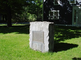
(marker on left)
This is where Seth Warner lived. After being away most of two years, with the Green Mountain Boys, fighting and patrolling the Lake George and Lake Champlain area, Seth was happy to be home in August for about a week before the Battle of Bennington. Having come down from Manchester with General Stark, he was a valued member of the councils of war, adding his personal knowledge of the terrain.
The farm did not do well while Seth was away. His oldest son was only 7 at the time of the attack on Ft. Ticonderoga and 9 at the Battle of Bennington. In 1781, Seth Warner, weakened by illness and injuries, retired from the Continental Army. In 1784, the Warners moved back to Roxbury, Connecticut, where he died on December 26, 1784, at the age of 41.
From this homestead, General’s Stark’s encampment was only a little over a mile away to the north and the Green Mountain Boys, when they arrived from Manchester, were camped only about 2 miles to the southeast. With communications by horseback, these two camps were not that far away.
There is speculation that Seth’s son Israel, then 9 years old, may have made one or more rides bearing messages from his father. Israel himself claims to have ridden from the Warren farmstead to Manchester to tell the Green Mountain Boys that the “British are Here!” on the 14th .
FORTY FEET WEST OF THIS SPOT STOOD THE HOME OF SETH WARNER
COLONEL OF THE GREEN MOUTAIN BOYS, DURING HIS RESIDENCE IN BENNINGTON.
HERO OF HUBBARDTON AND BENNINGTON BATTLES, 1777.
THE HOUSE WAS DESTROYED BY FIRE IN 1858
ERECTED BY THE CONNECTICUT AND MASSACHUSETTS SOCIETIES OF THE SONS OF THE AMERICAN REVOLUTION
AUGUST 16, 1927
Continue on Murphy Road north for about 100 yards.
Henry House

The Henry House was built at the same time as Seth Warner’s house in an identical style. William Henry fought in the Battle of Bennington. On August 14, 1777, on the way to the Battle of Bennington, Aaron Hubbell’s unit was asked to fell trees near here to block the advance of the British.
Continue on Murphy Road, crossing the Henry Covered Bridge.
Walloomsac River Crossing
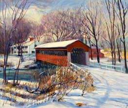
This section of the Walloomsac River is where the troops may have crossed on the way to the Battle of Bennington. Note how shallow the water is. There is a historic marker adjacent to the crossing. The Henry Bridge had not yet been built at the time of the Battle of Bennington.
Turn left onto Harrington Road. Proceed for 1.2 miles (8.1) to a marker on the right.
General Stark’s Encampment
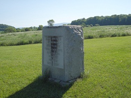
(August 14, 15 and 16), marked by a large stone on the hillside to the east.
Here, General Stark prepared his troops. When the British arrived on the afternoon of August 14th, General Stark paraded his troops back and forth, making it appear that he had more troops than he did. Colonel Warner sent word to his Green Mountain Boys in Manchester to come. Both sides spent the rainy 15th preparing for battle and waiting for re-enforcements.
On the 16th, it is said that General Stark made his oft quoted Battle cry, “Tonight the British will be ours, or Molly Stark sleeps a widow.”
GENERAL JOHN STARK’S CAMPING GOUND AUGUST 14-15-16, 1777.
“THERE ARE THE REDCOATS AND THEY ARE OURS, OR THIS NIIGHT MOLLY STARK SLEEPS A WIDOW.”
Colonel Baum (died here)
On the 16th, General Stark sent one group around the hill to the north and other across the river to the left in a flanking movement. At 3:00 p.m., the Battle began with the third group attacking from the east. Within a couple of hours the first phase of the battle was over. The British had been defeated. Prisoners and the wounded were being taken back to the Meeting House on the center green (in front of the Old First Church, which was built later).
About then, the British re-enforcement arrived. They attacked. Stark’s men were in disarray. But the Green Mountain Boys finally made the 3 mile march from their encampment and helped to rout the British re-enforcements.
Actually, most of the British forces in this battle were German mercenaries from the Brunswick area. Hence, they were called “Brunswickers” although you will also see references to the “Hessians”.
The hills to west are in New York. The main battle engagement took place just out of sight behind the nearest hill, where part of the battle action took place. The main battle engagement took place just out of sight behind the nearest hill.
Of the 1000 British troops 700 were captured and brought back to the Old Bennington green by the cemetery, 200 were killed and about 50 wounded. The Americans only lost about 25 killed and 35 wounded, according to early reports.
Continue north on Harrington Road for 0.8 miles (8.9) Route 67 (there is no street sign at this intersection). Turn left and go 0.2 miles (9.1) to a marker on the right.
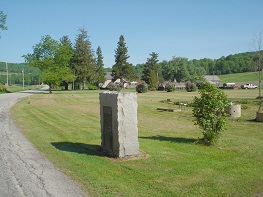
Lieutenant Colonel Friedrich Baum (the commander of the British [German] expidition) along with Colonel Pfister (Head of the Tories) died at a farmhouse near this marker from wounds received at the Battle of Bennington. Colonel Baum was the German officer in charge of the force sent to obtain supplies from the Bennington store house. When he arrived on the 14th and saw the number of men assembled under General Stark, he sent for re-enforcements. Then, he dug in on and around the hill to the west.
From Colonel Baum’s marker reverse your course to the Henry Bridge. Don’t go over the Bridge, but instead continue on in the direction you are traveling 0.5 miles (9.6) to the junction of route 67 at the old church. Turn right onto Route 67 and continue 1.6 miles (11.2) to the blinker light, turning left on Matteson Road. Continue 0.2 miles (11.4), turning right onto Rice Lane. Continue 0.7 miles to Route 7A. (12.1) You are on Harwood Hill where the Green Mountain Boys camped on August 15th prior to the Battle of Bennington. Turn right onto route 7A and proceed past the restaurant and turn into the parking lot at the Bennington Project Independence (BPI) for a view of the valley.
A FEW FEET EAST OF THIS MARKER STOOD THE HOUSE, REMOVED ABOUT 1870, IN WHICH LIEUTENANT-COLONEL
FRIEDRICH BAUM DIED. COMMANDER OF THE ENEMY FORCES, WE WAS MORTALLY WOUNDED IN THE BATTLE
OF BENNINGTON AND DIED TWO DAYS LATER, AUGUST 18, 1777. HE WAS BURIED ON THE NORTH BANK OF THE WALLOOMSAC RIVER, WEST OF THIS SITE. THE PRECISE SPOT NOT
NOW BEING KNOWN.
ERECTED BY THE VERMONT SOCIETY SONS OF THE AMERICAN REVOLUTION, 1927.
Harwood Hill
This is where the Green Mountain Boys camped on August 15, 1777.
The Green Mountain Boys had hiked down from Manchester on the 15th. It rained all day and their gear and gunpowder may have been wet. This was a farm owned by Zacheria Harwood, who was known for his hospitality and his hard cider. Look to the south and you will see the Battle Monument. The old road went straight down the hill into the valley and up through where the monument stands today. The Catamount Tavern is just a short distance past the monument on that old road which is today called Monument Avenue. Look to the northwest and you would be able to see (but for the trees) the Seth Warner Farmstead and the Battlefield.
